

 Chris Healy/photos by the author
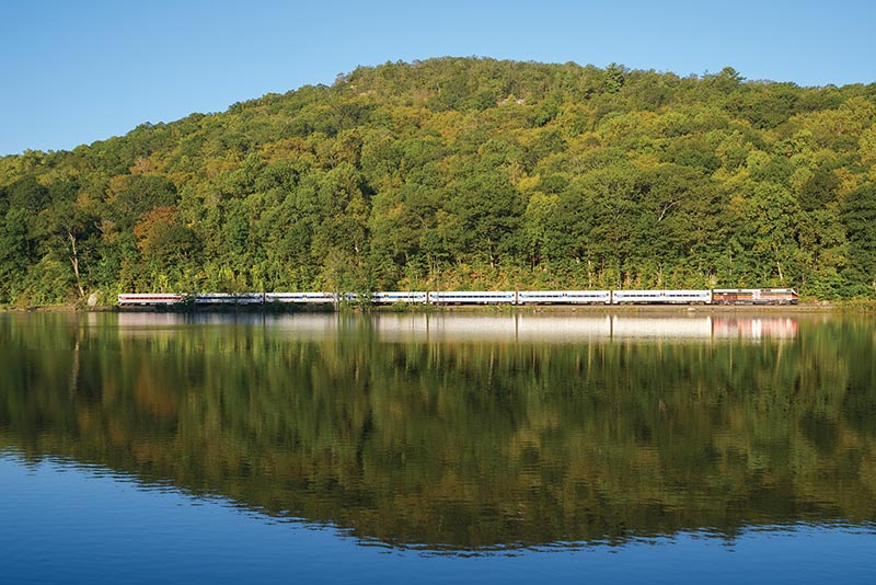
Leaving Grand Central Terminal, there are over 300 route miles that one can travel on Metro-North Railroad. This includes the former New York Central Railroad Hudson and Harlem Divisions, and the former New Haven Railroad electrified four-track main, including its three branches. Growing up and living east of the Hudson River in Rockland County in Piermont, New York, I have a great landscape view of the Hudson Line across the nearly three-mile-wide Hudson River; and now as a locomotive engineer for Amtrak on the NEC, I get to run Regionals and Acelas over the New Haven Line between New York Penn Station and Boston, Massachusetts. That leaves the Harlem Line, which has its own unique connection to me in a variety of ways.
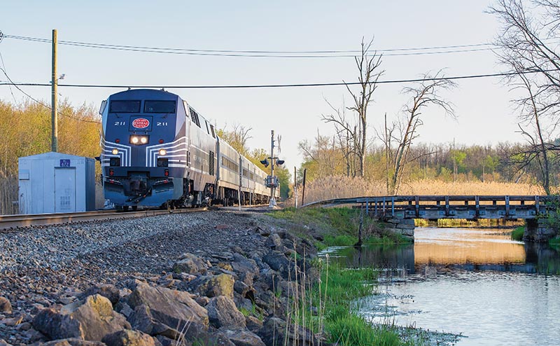
Metro-North Train 953, led by New York Central heritage unit 211, heads north over the former NYC Upper Harlem Division along the Swamp River in Pawling, New York, on the evening of May 4, 2026. The Harlem Line between Brewster and Wassaic features many locations where the railroad runs through large marshes and streams, and even open farmland. The Swamp River begins to follow the railroad directly north here at Pawling. As we travel north from Brewster along the single main track, we’ll take a closer look at some locations including this river, and other unique vantage points hidden in Dutchess and Putnam Counties.
During my mid-teenage years, I would often get dropped off at the Harlem Line station at North White Plains to take the train to the currently northernmost terminus of the Harlem Line in Wassaic, where I’d spend summer weekends visiting close relatives who lived in Sharon, Connecticut. The Harlem Line north of Brewster, New York, runs parallel to the New York/Connecticut border by only three to five miles, offering a lesser-known gateway to western Connecticut and the Berkshires. The Upper Harlem Line is non-electrified single-track with three passing sidings, extending through an impressive mixture of wetlands, streams, and farm country, a significant change of scenery from the Hudson and New Haven Lines.
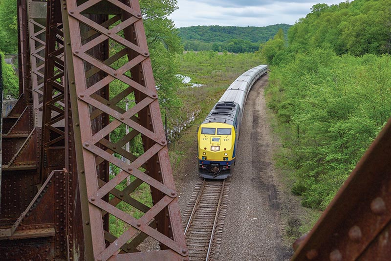
We are now standing on the former New Haven Maybrook Line bridge over the Harlem Line at Towners as we see Train 943 led by Penn Central heritage unit 217, this time on May 13, 2025. Prior to 2021, this part of the Maybrook Line had not yet been reconfigured into a bike trail, and it was dangerous to attempt a photo angle on the bridge. However in 2021, New York State converted parts of the once double-track Maybrook line into a walking path and incorporated it into the Empire State Trail, providing a continuous uninterrupted pedestrian path for over 100 miles between New York City and Kingston, New York. The southern part of this trail is built on the right-of-way of the former New York Central Putnam Division between Yonkers and Brewster, with the Maybrook Line portion in the mid-section connecting to the Wallkill Valley Rail Trail on the Highland side of the Poughkeepsie Bridge.
A few years later in life, once I became a licensed driver and began college, I began making railfan trips to the area north of Brewster to scope out lesser-known locations that I remembered seeing from riding the train, that had unique scenic potential and variety. I became intrigued by the rural scenery along the Upper Harlem Line that offered a different perspective from busy commuter trains which differed from the water-level Hudson Line and the metropolis of the New Haven Line. I particularly favored the location where the Upper Harlem Line and dormant New Haven Maybrook Line cross at a large truss bridge in Towners, New York…
